The three critical maritime choke points for the IOR are the Strait of Hormuz, the Bab-el-Mandeb, and the Strait of Malacca.
These narrow passages are vital for global energy and trade flows, making them highly sensitive to geopolitical tensions and maritime security challenges.
The Cape of Good Hope is not a conventional choke point, since adequate space and depth of water lies to its South and the passage of ships is not restricted by land. However, economic considerations and strong currents encourage ships to route closer to the coast. Ships that cannot pass through the Suez Canal follow this route. There was substantial increase in traffic in this area when the Suez Canal was shut down from 1967 – 1975.
The Mozambique Channel is approximately 1,000 nautical miles (nm) long and 250 nm wide at its narrowest point. The usage of this channel reduced after the Suez Canal opened in 1869. However, with estimations of Mozambique holding over 100 trillion cubic feet of recoverable natural gas (one of the largest gas finds in the world) and huge coal reserves, the channel may regain prominence as an important sea route and choke point.
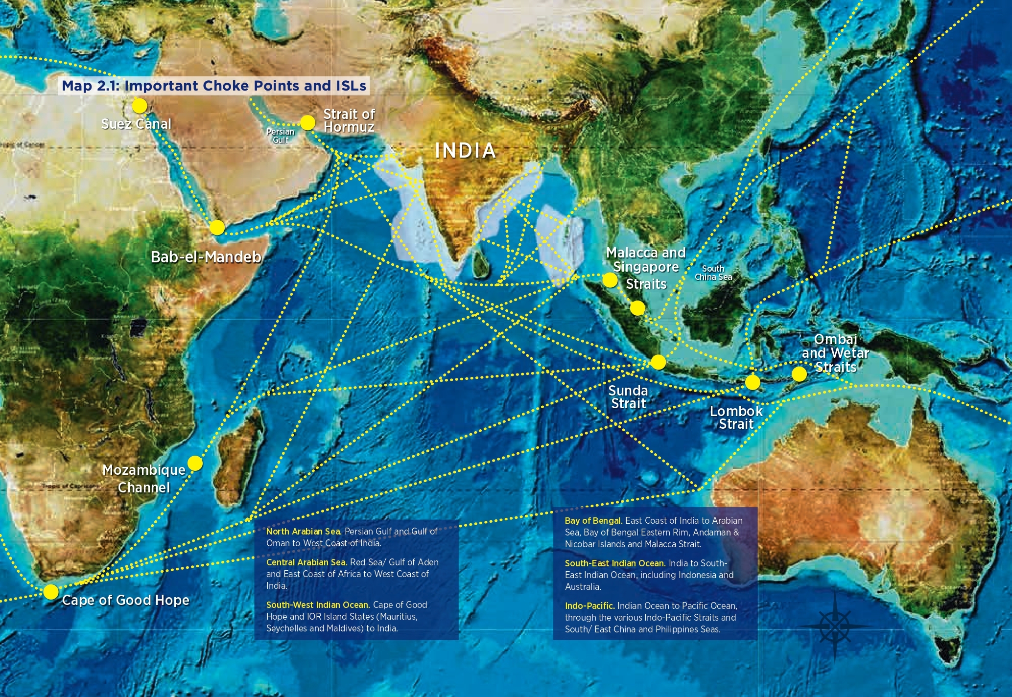
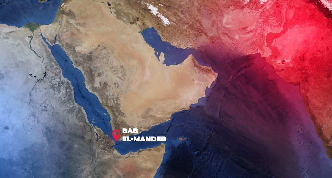
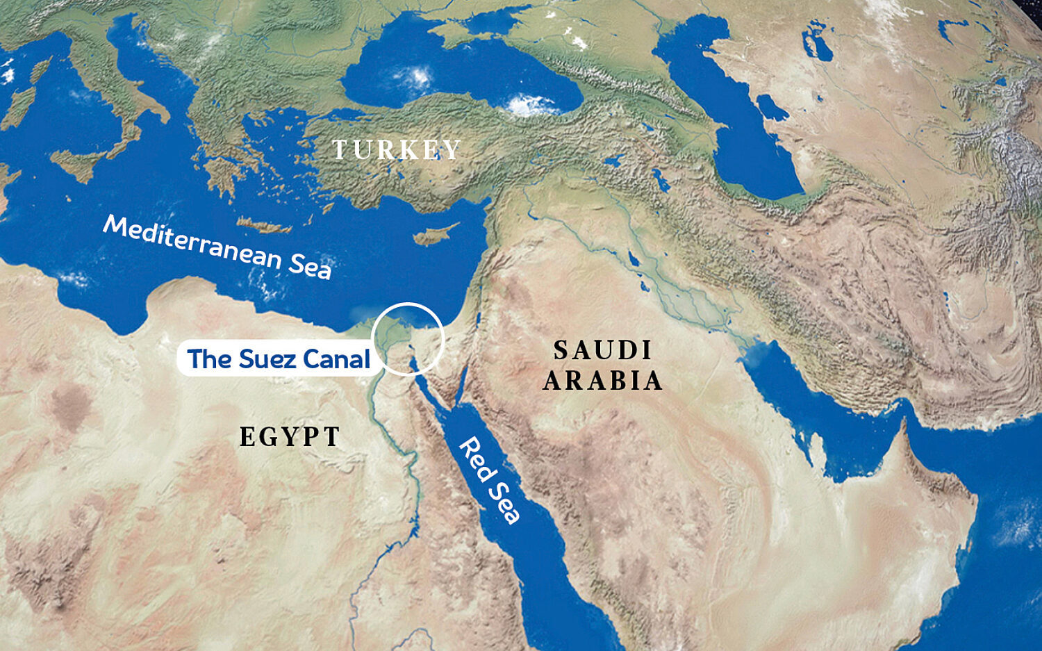
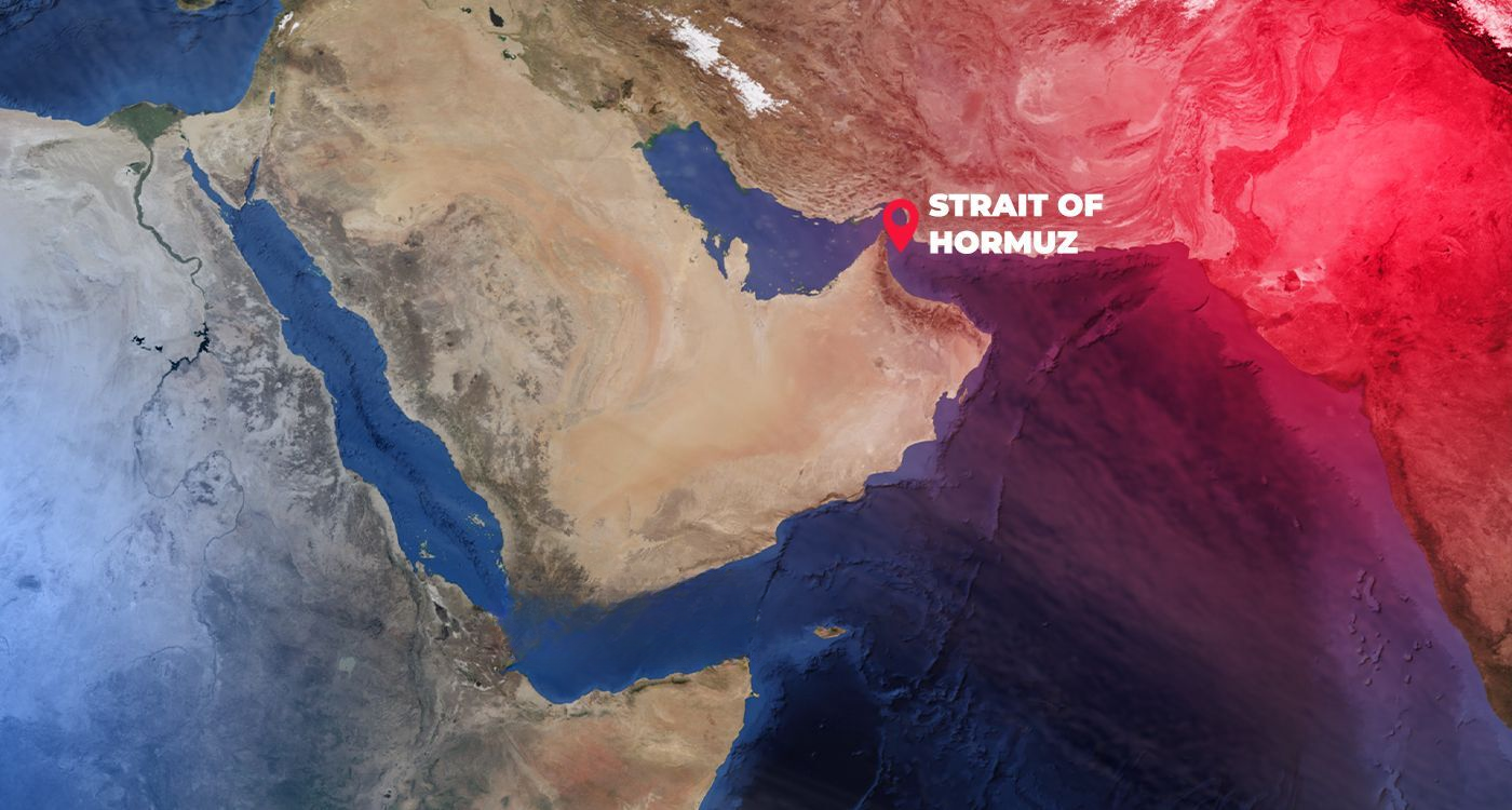
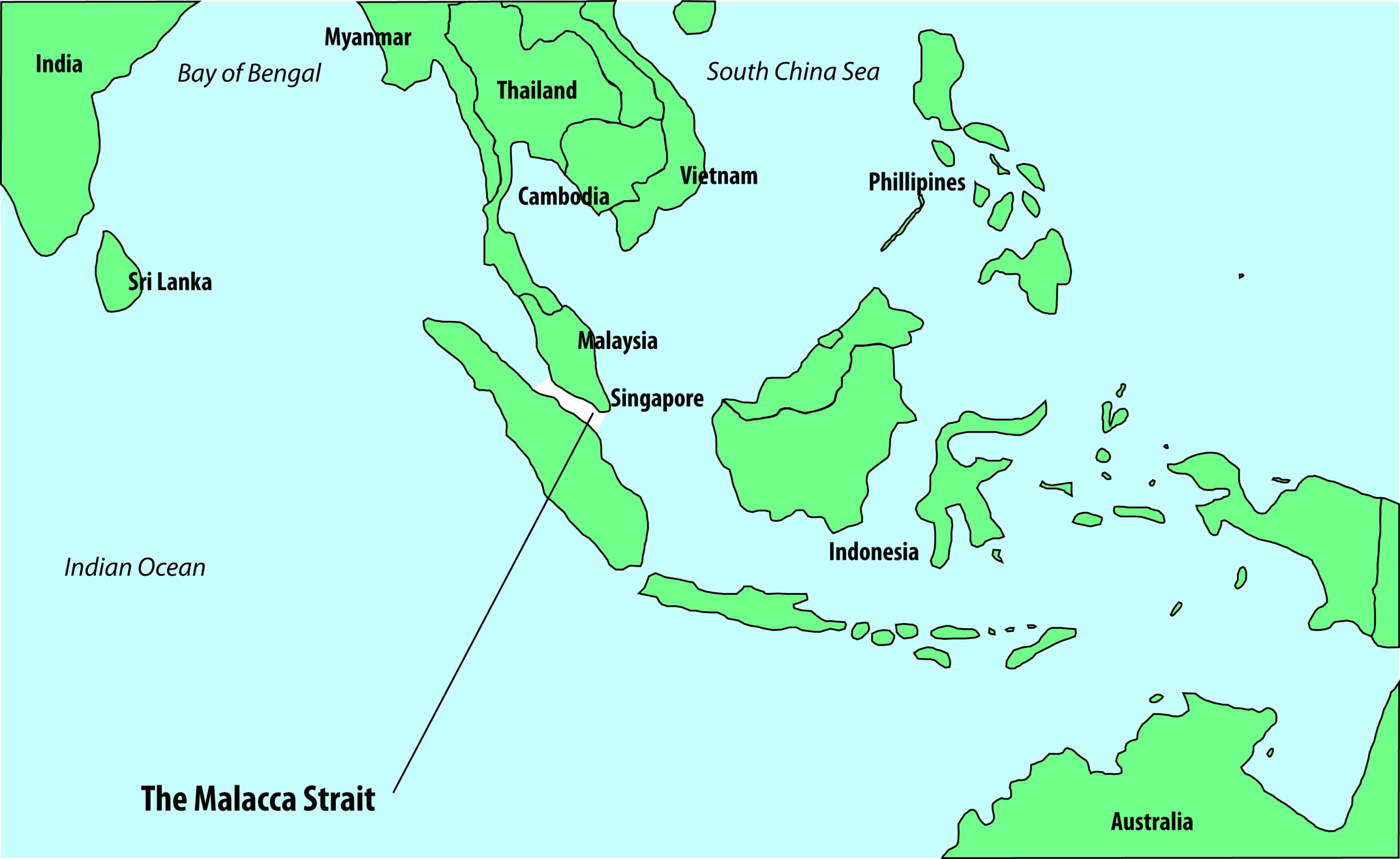
Bab-el-Mandeb is a 17 nm wide stretch of water that connects the Gulf of Aden with the Red Sea and, thence, the Suez Canal. Closure of the Bab-el-Mandeb, for any reason, would cut-o the Red Sea littoral from the Arabian Sea and Asia, and also prevent access to the Suez Canal. This would necessitate significant increase in shipping and tanker capacities, via other ISLs and choke points, to maintain the rate of oil and trade flow.
The 105 nm long Suez Canal is the maritime gateway between Europe and Asia. Closure of the Suez Canal, for any reason, would cause traffic to be diverted around the Cape of Good Hope, thereby increasing the transit time and transportation costs. To illustrate, the distance between Mumbai to London is 6,200 nm via the Suez Canal, and 10,800 nm via the Cape of Good Hope.
The Strait of Hormuz, connecting the Persian Gulf to the Gulf of Oman and Arabian Sea, has a width of about 30 nm and primary navigable channel across a six nm wide zone. It has no maritime detour, rendering it as a critical choke point. About 17 million barrels of oil pass through this Strait each day, representing 35% of the world’s oil trade by sea. Any closure of this strait would severely aect energy security of many nations, including India.
The Straits of Malacca and Singapore link the Indian Ocean to the South China Sea and Pacific Ocean. Providing the shortest sea route from the Persian Gulf to East Asia/ West Pacific regions, it is a strategic choke point in the IOR. A dense shipping zone, more than 70,000 ships transit it each year. The narrowest point amongst the two straits is the 1.5 nm wide navigable stretch of the Phillip Channel in the Singapore Strait.
An alternative route to the Malacca and Singapore Straits is the Sunda Strait, which is 50 nm long and 15 nm wide at its North-East entrance. Large ships do not prefer passage through this strait due to navigational hazards, depth restrictions and strong currents.
The Ombai Strait lies between the islands of Alor and Timor, and the Wetar Strait lies between the islands of Timor and Wetar. Due to longer distance, routeing through this area is not normally preferred as an alternative to the Malacca and Singapore Straits. The route provides adequate depth for submarines to transit submerged between the Indian and Pacific Oceans.
At a minimum channel width of 11.5 nm, the Lombok Strait has sufficient width and depth, with lesser congestion, and provides an alternative passage between the Indian and the Pacific Oceans, especially for larger ships.
The Indian Ocean Naval Symposium (IONS) is a voluntary initiative that brings together the navies of the Indian Ocean littoral states. Through dialogue, co-operation, and shared understanding, IONS fosters regional maritime security and stability across one of the world’s most strategic oceanic regions.
© Indian Ocean Naval Symposium (IONS) 2026 – All Rights Reserved